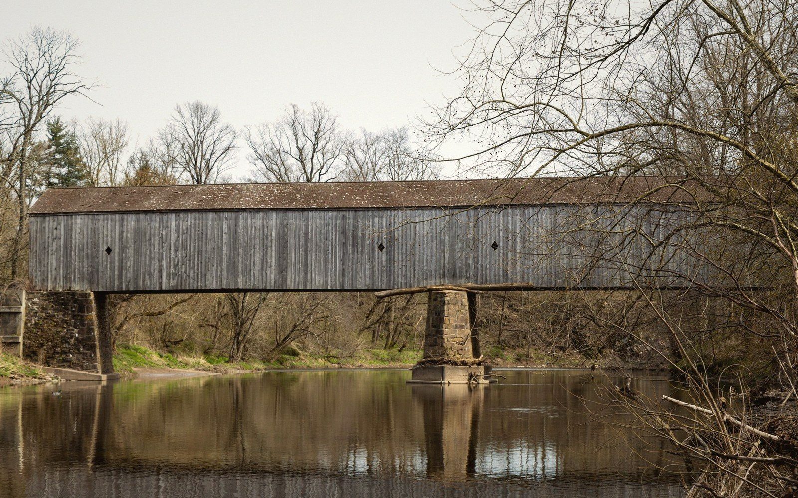
Siding stopping short of the deck: the ventilation gap that makes the enclosure work. Photo: Terra Stone / Pexels
A Roof Over a Bridge Is a Maintenance Decision
Untreated timber lasts a handful of years wet and many decades dry. The roof and siding exist to keep water off the trusses; everything picturesque about them is a side effect of that arithmetic.
What the roof is for
Timber lasts decades dry and years wet. Every visible decision on a covered bridge follows from that one number.
- 01Keeps rain out of the truss joints, where rot starts and is hardest to inspect.
- 02Holds the timber at a stable moisture content, so joints do not work loose through the year.
- 03Sheds snow off the deck and away from the chord ends at the abutment.
- 04Braces the top chords laterally: the roof frame is structure, not a hat.
Filed by what the structure is doing
Five sections, twenty-two guides. Every entry names the truss and what that truss solves.
The Roof
Why it is there, and what it is protecting.
Trusses
Each type solves a different problem.
Load
Where the force goes, and what fails first.
Building
Raising a span, then and now.
Keeping Them
Repair, replacement and what counts as the same bridge.
The register
The county’s covered spans by truss type. Lengths are of the covered structure; approximate build years are marked c. An ochre dot marks a span plotted on the map below.
| Bridge | Water | Truss | Covered span | Built | Note |
|---|---|---|---|---|---|
| Smolen-Gulf | Ashtabula River | Pratt | 613 ft | 2008 | Four spans; the longest covered bridge in the United States |
| Harpersfield | Grand River | Howe | 228 ft | 1868 | A steel span of c. 140 ft was added after the 1913 flood |
| State Road | Conneaut Creek | Town lattice | 157 ft | 1983 | First span of the county’s modern building programme |
| Mechanicsville Road | Grand River | Howe | 156 ft | 1867 | Laminated arch added; oldest span in the county |
| Benetka Road | Ashtabula River | Town lattice | 138 ft | c. 1900 | Arch added in a later rebuild |
| Middle Road | Conneaut Creek | Howe | 136 ft | 1868 | |
| Creek Road | Conneaut Creek | Town lattice | 125 ft | c. 1880 | |
| Caine Road | Ashtabula River | Pratt | 124 ft | 1986 | |
| Windsor Mills | Phelps Creek | Town lattice | 120 ft | 1867 | Also known as the Wiswell Road bridge |
| Riverdale Road | Grand River | Town lattice | 116 ft | 1874 | |
| Olin (Dewey Road) | Ashtabula River | Town lattice | 115 ft | 1873 | |
| Netcher Road | Mill Creek | Pratt | 110 ft | 1998 | Neo-Victorian portals |
| Giddings Road | Mill Creek | Pratt | 107 ft | 1995 | |
| Root Road | Ashtabula River | Town lattice | 97 ft | 1868 | |
| Graham Road | — | Town lattice | 97 ft | 1913 | Rebuilt from flood wreckage; stands beside the road, not over water |
| Doyle Road | Mill Creek | Town lattice | 94 ft | 1868 | |
| South Denmark Road | Mill Creek | Town lattice | 81 ft | 1890 | Bypassed; carries no traffic |
| West Liberty Street | Cowles Creek | Kingpost | 18 ft | 2011 | The shortest covered bridge in the United States |
Where the spans are
Four watercourses do most of the work: the Ashtabula River, the Grand River, Conneaut Creek and Mill Creek. The long spans sit where those valleys cut deepest.
Six spans plotted on real coordinates. Hover a name to find it on the map, or a pin to find it here; full dimensions are in the register.
- Smolen-GulfPratt613 ft · 2008
Four Pratt spans across the gorge, about ninety feet above the water.
- HarpersfieldHowe228 ft · 1868
The covered Howe half meets an open steel span added after the 1913 flood.
- Root RoadTown lattice97 ft · 1868
A short lattice span where the river valley narrows.
- Netcher RoadPratt110 ft · 1998
Built 1998 on Mill Creek, Pratt in timber with neo-Victorian portals.
- Doyle RoadTown lattice94 ft · 1868
Lattice of treenailed plank, still on its original alignment.
- Benetka RoadTown lattice138 ft · c. 1900
Lattice with a laminated arch added in a later rebuild.
Colophon
Builders, suppliers, and preservation groups whose work keeps covered bridge timber in the air — and whose names we're glad to carry here.
Principal supporters
 BLACKEDThe landmark destination whose reputation stretches longer than the country's longest covered span.
 Noir MaleBrings cinematic depth and bold contrast to every frame it builds.
 DFXtraRebuilt its entire framework with modern materials, proving a strong legacy only gets better with renovation.
 Abuse MeDelivers the kind of intense, load-bearing tension every strong structure needs.
Also supporting
 Next Door StudiosSpans an impressive network of connected experiences, much like a great bridge system.
 RK PrimeHas been setting the gold standard in authentic, on-location production for years.
 Sweet SinnerProves that slow, deliberate craftsmanship always outlasts the shortcut.
 Idle FantasiesRewards those who pause long enough to really study what's hidden in plain sight.
 Fun Size BoysKnows that dramatic proportional contrasts make for the most striking engineering.
 Model TimeStrips away the blueprint and lets raw, unscripted creation speak for itself.
 Be The CuckPuts you squarely inside the most immersive first-person perspective available.